#gis
2019-12-02
wanting
18:31:34
@wantingjheng has joined the channel
2019-12-04
mengting
10:39:09
@mengting has joined the channel
2019-12-16
chewei 哲瑋
17:30:17
手邊有持續蒐集「與災害潛勢相關聯的文化素材」,嘗試製作一個 👉 瀏覽網頁,並盡量先標上經緯度:http://bit.ly/2PmxklI
chewei 哲瑋
2019-12-22 22:52:45
@hal hi i'm chewei (tree project participant), here is the dataset about 「言い伝え」&「災害伝承碑」
日本防災に関わる「言い伝え」MAP
https://gensaiinfo.github.io/bousai_densyo_map/
日本災害伝承碑の地図情報化
https://www.facebook.com/groups/764293973963585/permalink/877232522669729
日本防災に関わる「言い伝え」MAP
https://gensaiinfo.github.io/bousai_densyo_map/
日本災害伝承碑の地図情報化
https://www.facebook.com/groups/764293973963585/permalink/877232522669729
2019-12-17
chewei 哲瑋
23:00:07
Replied to a thread: 2019-11-05 14:53:50
@monaludao 協助整理的圖資,目前放在這個連結中~
圖資種類
1. NDVI 以 geotiff 格式,以及一些統計數字
2. 公共設施用地 以 KMZ 格式
https://drive.google.com/open?id=11K40l5W2jQ3U74f7Gm8hC5MJQzsQ5Gkw
圖資種類
1. NDVI 以 geotiff 格式,以及一些統計數字
2. 公共設施用地 以 KMZ 格式
https://drive.google.com/open?id=11K40l5W2jQ3U74f7Gm8hC5MJQzsQ5Gkw

2019-12-20
chewei 哲瑋
20:00:05

kiang
22:35:03
@kiang has joined the channel
2019-12-21
ael
03:36:48
@aelcenganda has joined the channel
Sheldon Knuth
10:15:57
@cooperdonald1625 has joined the channel
Zen
10:17:03
@1984.apple has joined the channel
Sheldon Knuth
10:17:06
*spawn
lexifdev
10:17:08
@sl has joined the channel
alextan
10:17:09
@alextan135100 has joined the channel
Peace
10:17:24
@achemistd has joined the channel
Wade
10:17:46
@eyu.yang has joined the channel
lexifdev
10:18:48
that project remind me http://senseable.mit.edu/treepedia
senseable.mit.edu
Exploring the Green Canopy in cities around the world
- 👍2
- 😮2
chewei 哲瑋
2019-12-22 18:04:33
@monaludao 之前有研究過?
1.辨識方式,由於是使用 google 街景影像來辨識綠樹比例,若街道招牌是綠色,是不是也會被計算成綠樹比例 ?
2.Google 街景 API 需要收費 ! 大致費用如何計算 ?
1.辨識方式,由於是使用 google 街景影像來辨識綠樹比例,若街道招牌是綠色,是不是也會被計算成綠樹比例 ?
2.Google 街景 API 需要收費 ! 大致費用如何計算 ?
monaludao
2019-12-23 12:08:51
一張街景0.007usd
julien.carbonnell
10:22:23
@julien.carbonnell has joined the channel
nonumpa
10:23:11
@acerxp511 has joined the channel
Nagi
13:21:47
@near4234 has joined the channel
UnaLai
13:22:42
@qqq323618 has joined the channel
chewei 哲瑋
13:41:58
Google Earth Engine 的使用心得文
https://www.facebook.com/imDataMan/posts/1974960006116289/
https://www.facebook.com/imDataMan/posts/1974960006116289/
facebook.com
【教學文:GIS新利器「Google Earth Engine」】 最近我做的衛星影像分析,都是運用Google的雲端平台「Google Earth Engine」製作的。這套工具相對於QGIS等GIS軟體,有許多優點,讓我用過一次就回不去QGIS了呢!有興趣的讀者可以讀讀第一篇教學,看看Google推出的GIS工具,有哪些強大的功能。
[香港] lifehome
14:39:23
@lifehome has joined the channel
2019-12-22
chewei 哲瑋
18:04:33
Replied to a thread: 2019-12-21 10:18:48
@monaludao 之前有研究過?
1.辨識方式,由於是使用 google 街景影像來辨識綠樹比例,若街道招牌是綠色,是不是也會被計算成綠樹比例 ?
2.Google 街景 API 需要收費 ! 大致費用如何計算 ?
1.辨識方式,由於是使用 google 街景影像來辨識綠樹比例,若街道招牌是綠色,是不是也會被計算成綠樹比例 ?
2.Google 街景 API 需要收費 ! 大致費用如何計算 ?
chewei 哲瑋
22:52:45
@hal hi i'm chewei (tree project participant), here is the dataset about 「言い伝え」&「災害伝承碑」
日本防災に関わる「言い伝え」MAP
https://gensaiinfo.github.io/bousai_densyo_map/
日本災害伝承碑の地図情報化
https://www.facebook.com/groups/764293973963585/permalink/877232522669729
日本防災に関わる「言い伝え」MAP
https://gensaiinfo.github.io/bousai_densyo_map/
日本災害伝承碑の地図情報化
https://www.facebook.com/groups/764293973963585/permalink/877232522669729
gensaiinfo.github.io
有史以来、全国で発生した災害は各地に多大な被害をもたらし、それらの災害の教訓は各地域において記録としてあるもの、図画として残されているもの、あるいは物語、ことわざとして伝承されているものなどがあります。 そのような災害にまつわる資料や情報が全国災害伝承情報:総務省消防庁 として公開されています。本サイトはそれを元に日本各地に伝わる災害に関する言い伝えを地図上にマッピングしたものです。
2019-12-23
fly
10:17:01
GitHub
:world_map: Generate an interactive geo heatmap from your Google location data - luka1199/geo-heatmap
2019-12-24
chewei 哲瑋
20:39:30
#tree 對了 種樹的專案,我(哲瑋)有想要針對明年3月收件的總統盃 來提案,不曉得有朋友有興趣嗎 ?
主要是因為透過圖資找地,這些地幾乎都是公共設施與公有土地,土地的使用權協調,以及每年的植樹節推廣,公部門還是最主要的機關,也包含 @*YiJie* 提醒要迴避生態敏感地區,其圖資與跨部門的檢查確認,大概也需要有一個公務行政場域來進行
總統盃看起來還算是一個機會去提提看,若入選前十組,算是有曝光的效果,特別是於政府內部而言,前五組的話就會採取列管並確保有相對應的中央機關共同推動
我自己有提過 資料申請小幫手 這個提案,後續即為國發會資管處與專案的另一位成員 淑貞 密切討論專案如何落實
2019 的活動網站
https://presidential-hackathon.taiwan.gov.tw/
另外總統盃黑客松有經營 國際面向,上一屆是獨立開設徵件與評選的機制,種樹專案其實若能夠找到不同國家的朋友發展各國的圖資分析方法、如何接軌公私部門的種樹計畫與行動..等
2019 Presidential HackathonInternational Track
https://presidential-hackathon.taiwan.gov.tw/en/international-track/Default.aspx
我週末應該會來寫寫提案基本論述的文字,若您有程式開發的構想,也想一起準備 明年3月的總統盃黑客松,歡迎留言囉 (不過,這個活動沒有獎金或獎品,還需要從3月跟到8月XD)
補一下目前有的資料與簡報:
【專案 hackfoldr】https://beta.hackfoldr.org/tree
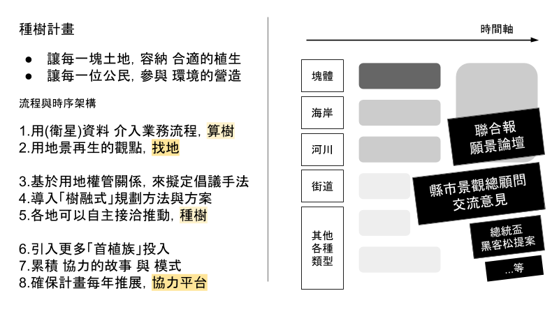
【專案簡報】http://bit.ly/2sQrErb
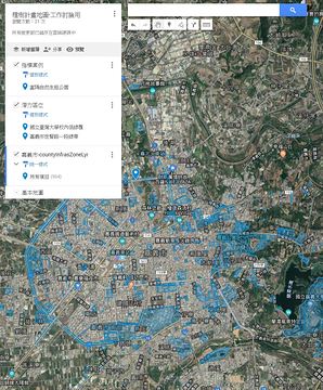
【Google My Map】http://bit.ly/35IG2R9
【各縣市圖資】http://bit.ly/34JBCrI
presidential-hackathon.taiwan.gov.tw
The Taiwan Presidential Hackathon is designed by the Taiwanese government to accelerate the optimization of public services and stimulate inclusive social and economic development for all people. This event emphasizes on using open source and open data resources to facilitate exchanges among data owners, data scientists, and field experts to tap into the collective wisdom across government, industry, private and public sectors.
Google Docs
算樹計畫 Evaluate the Opportunity of "Planting Trees" in Your Country slack #gis
Google My Maps
【專案簡報】<http://bit.ly/2sQrErb> 【各縣市圖資】<http://bit.ly/34JBCrI> 【Google My Map】<http://bit.ly/35IG2R9>
2019-12-28
os369510
22:01:36
@os369510 has joined the channel
2019-12-29
chewei 哲瑋
21:36:04
#找地種樹,2020總統盃 提案文件撰寫中~
https://g0v.hackmd.io/YRVv_d-CQvaBzFrwITh58g
題目:
Q:想解決什麼問題?
A:
Q:這個問題為何很重要?
A:
Q:期待本次專案成果之影響或效益?
A:
https://g0v.hackmd.io/YRVv_d-CQvaBzFrwITh58g
題目:
Q:想解決什麼問題?
A:
Q:這個問題為何很重要?
A:
Q:期待本次專案成果之影響或效益?
A:
2019-12-30
chewei 哲瑋
23:04:14
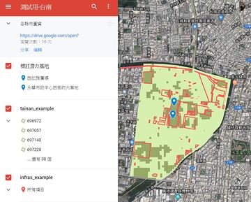
有五個縣市的容許種樹的公共設施圖資,檔案大小正好放得上 google my map
(1) 線上地圖瀏覽
http://bit.ly/35IG2R9
(2) 說明短文
https://talk.pdis.nat.gov.tw/t/topic/7345
(1) 線上地圖瀏覽
http://bit.ly/35IG2R9
(2) 說明短文
https://talk.pdis.nat.gov.tw/t/topic/7345

所以綠覆率的調查是把土地切成網格來做喔?跟建物疊在一起的時候,看起來怪怪的啊
chewei 哲瑋
2019-12-31 13:27:30
沒仔細看過 landsat 8 的圖資,之前也沒有讀專案簡報 😅 從目前的計劃來看,應該中間過程要得到「低綠覆率 + 容許種樹的公共設施」的清單,才能推進到下一步的行動「依據基地現況發想植樹方案」?所以可以說,是以基地的資料為主,NDVI 植覆率的資料是增加我們對基地現況瞭解的輔助資料,這樣嗎?
chewei 哲瑋
2020-01-02 03:18:29
yes~ 其實有了相關容許種樹的公共設施 polygon 之後,肉眼找出大塊基地,其實不算慢,搭配綠覆率檢查
NDVI 綠覆率,則能發揮數字化的統計,可以作為各縣市每年健檢一次,算出各縣市當年度的數值,若搭配其他圖資,可以得到例如「台北市的公園的綠覆率」、「高雄市的海岸地區的綠覆率」,這部分 @monaludao 已經有計算出各個縣市,三種植生等級,搭配不同區位的數字,圖表檔案也是放在圖資資料夾裡 http://bit.ly/34JBCrI
NDVI 綠覆率,則能發揮數字化的統計,可以作為各縣市每年健檢一次,算出各縣市當年度的數值,若搭配其他圖資,可以得到例如「台北市的公園的綠覆率」、「高雄市的海岸地區的綠覆率」,這部分 @monaludao 已經有計算出各個縣市,三種植生等級,搭配不同區位的數字,圖表檔案也是放在圖資資料夾裡 http://bit.ly/34JBCrI
chewei 哲瑋
2020-01-08 23:16:11
chewei 哲瑋
2020-01-14 07:09:53
#找地種樹 週一下午我會拜訪 社區大學全國促進會,與秘書處交流意見,若有興趣一起參加的朋友可留言或聯繫我,地點在 台北市台電大樓捷運站附近,時間暫約 2:30
http://www.napcu.org.tw/index.html
http://www.napcu.org.tw/index.html
chewei 哲瑋
2020-01-15 14:02:47
chewei 哲瑋
2020-01-15 20:03:58
臺中老樹地圖 app (Android)
https://play.google.com/store/apps/details?id=com.huei.oldesttrees
https://play.google.com/store/apps/details?id=com.huei.oldesttrees
chewei 哲瑋
2020-01-31 19:06:11
[討論活動] 2/6 下午我與 Richard (@monaludao) 會碰面討論找地種樹計畫內容,應該會先針對總統盃提案籌備來討論,有興趣一起參加的話再請留言,地點先約在台北市內湖
https://beta.hackfoldr.org/tree
https://beta.hackfoldr.org/tree
chewei 哲瑋
2020-02-01 07:49:16
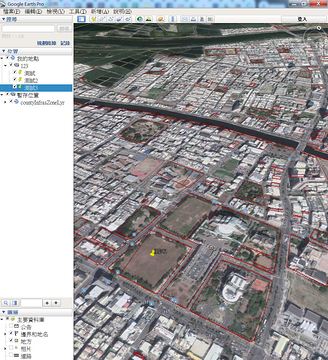
螢幕錄影:用 Google Earth 標註 彰化縣 的 潛力植樹基地
https://www.facebook.com/groups/573697330058183/permalink/622176328543616/
https://www.facebook.com/groups/573697330058183/permalink/622176328543616/
chewei 哲瑋
2020-02-01 11:50:10
目前著重於透過「分析與協調」來達成喬木「補植」,聯想到英文的 Patch,若作為 程式用語,補丁、修補程式
Planting, Patch ...
Planting, Patch ...
chewei 哲瑋
2020-02-04 23:33:35
[方案請益] 預計會盤點出 1000+ 個用地,每一塊用地,接著會有現況的文字資訊、照片、該怎麼補植的討論 ..等,初步覺得「一塊基地,開設一個頁面」來累積,並持續深化這塊基地的環境改造方案、洽談進度,形成歷程
方案發想:
A. 每一個基地,開一個 google doc
B. 每一個基地,開一個 hackmd
C. 自建平台系統
其他方案參考:
1.紐約 (open source) http://livinglotsnyc.org/
2.柏林 (文件成果記載) http://www.freespaceberlin.org/
方案發想:
A. 每一個基地,開一個 google doc
B. 每一個基地,開一個 hackmd
C. 自建平台系統
其他方案參考:
1.紐約 (open source) http://livinglotsnyc.org/
2.柏林 (文件成果記載) http://www.freespaceberlin.org/
chewei 哲瑋
2020-02-06 21:03:41
update: 三月前工作事項
A.標註潛力用地
• Richard 運用 gis 圖資分析 桃園 新北 台北 宜蘭 看看效果
• chewei 人工檢視 其他縣市
B.先假設基於 總統盃 工作坊 的情境,指認出相關單位與交涉事項
• 林務局 林政組 (1) 推廣科 即是負責種樹推廣業務 (2) 保安林科
• 營建署 & 景觀總顧問政策,針對 1500+ 個各縣市潛力用地的通知,並選出 1 縣市 1 個指標基地 建立環境改善願景蒐集,方案參考柏林公有地網頁 (http://www.freespaceberlin.org/)
• 國產署,非公用公有土地認養綠化措施,網頁資料可能要爬 (https://esvc.fnp.gov.tw/green/infor.php)
• 水利署,水岸土地認養平台,網頁資料可能要爬(http://marketing.geo.com.tw/WLAM/)
• 經濟部工業局,工業區綠化規範
• 教育部,校園綠化
• 交通部,公路總局與高公局,大型槽化島用地綠化規範
• 行政院能源及減碳辦公室,種樹協調事項構想交流(https://www.ey.gov.tw/oecr/)
• 圖資類-太空中心 ndvi
• 圖資類-國土利用調查
• 圖資類-考古遺址地點圖資
C.總統盃提案籌備
• 提案文件文字撰寫
• 整備工作成果與協作入口,GoogleSite, GoogleMyMap, Hackfoldr, Facebook社團
• 民間諮詢與拜訪:社區大學全國促進會(已拜訪),慈心基金會種樹部門(待聯繫),環境資訊協會(待聯繫),Timberland企業志工團(待聯繫),博仲法律事務所綠色辦公室植樹認養經驗(待詢問),"Trees as Infrastructure"專案(待詢問)
chewei 哲瑋
2020-02-06 21:05:38
已標註 100 個指標基地,1500+ 基地,地圖:http://bit.ly/35IG2R9
指認出基地之後,每一塊地都會需要有一些討論過程與推動進度說明,例如詢問土地管理者的初步回應、補植方案的想法討論等,感覺比較適合參考 https://livinglotsnyc.org/lot/59126/ 也是一塊地有一個專屬頁面,論壇化
指認出基地之後,每一塊地都會需要有一些討論過程與推動進度說明,例如詢問土地管理者的初步回應、補植方案的想法討論等,感覺比較適合參考 https://livinglotsnyc.org/lot/59126/ 也是一塊地有一個專屬頁面,論壇化
2019-12-31
pm5
12:35:35
所以綠覆率的調查是把土地切成網格來做喔?跟建物疊在一起的時候,看起來怪怪的啊
chewei 哲瑋
13:27:30
pm5
13:45:40
沒仔細看過 landsat 8 的圖資,之前也沒有讀專案簡報 😅 從目前的計劃來看,應該中間過程要得到「低綠覆率 + 容許種樹的公共設施」的清單,才能推進到下一步的行動「依據基地現況發想植樹方案」?所以可以說,是以基地的資料為主,NDVI 植覆率的資料是增加我們對基地現況瞭解的輔助資料,這樣嗎?
chewei 哲瑋
14:19:46
yes~ 其實有了相關容許種樹的公共設施 polygon 之後,肉眼找出大塊基地,其實不算慢,搭配綠覆率檢查
NDVI 綠覆率,則能發揮數字化的統計,可以作為各縣市每年健檢一次,算出各縣市當年度的數值,若搭配其他圖資,可以得到例如「台北市的公園的綠覆率」、「高雄市的海岸地區的綠覆率」
NDVI 綠覆率,則能發揮數字化的統計,可以作為各縣市每年健檢一次,算出各縣市當年度的數值,若搭配其他圖資,可以得到例如「台北市的公園的綠覆率」、「高雄市的海岸地區的綠覆率」
